Exprodat, the oil and gas ArcGIS platform specialist, has released the latest version of its popular Data Assistant software for ArcGIS Pro, which further simplifies and speeds up the transfer of exploration data to and from Esri’s ArcGIS platform.
Version 2 of Data Assistant for ArcGIS Pro enables users to visualise seismic trace images within an ArcGIS Pro 3D scene and enhance them with the addition of specialist symbology such as seismic shot points, earthquake ‘beach balls’ and third-party colour ramps.
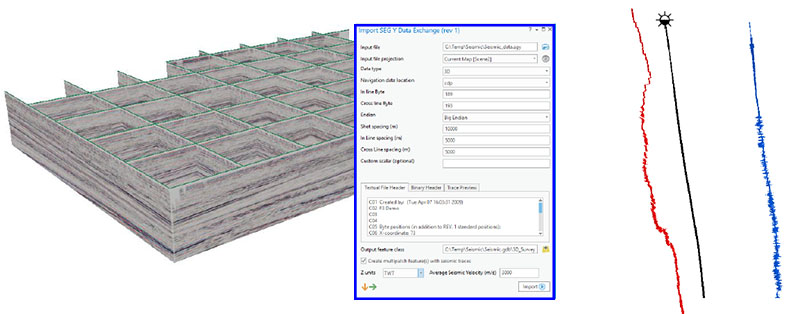
Further, the new version allows you to import Deviation surveys, to allow easy GIS visualisation of the subsurface borehole path, and well Log ASCII Standard (LAS) curves such as gamma ray, neutron porosity and resistivity logs alongside the borehole trajectory.
Exprodat’s COO, Chris Jepps, explains how this new version represents a leap forward for Data Assistant users: “The new version of Data Assistant for ArcGIS Pro allows geoscientists to load a simple well deviation survey of inclination, azimuth and measured depth data to generate a subsurface well path. This is a huge step forward for geoscientists who use GIS.”
“Combining this with the release’s other new capabilities of displaying well logs adjacent to the 3D borehole, and plotting all this well data against seismic trace images, permits any geoscientist to easily build a picture of their subsurface project within the powerful ArcGIS Pro 3D environment, all from petroleum industry standard data formats such as Deviation Surveys, LAS Surveys and SEG-Y.”
KeyFacts Energy Industry Directory: Exprodat