MCG and Geoex present the Caribbean Atlantic Margin Deep Imaging (CAMDI) survey.
This 16,433 km survey is targeting the highly prospective and underexplored basin along the Southeastern Caribbean and Western Atlantic margin of Northeast South America.
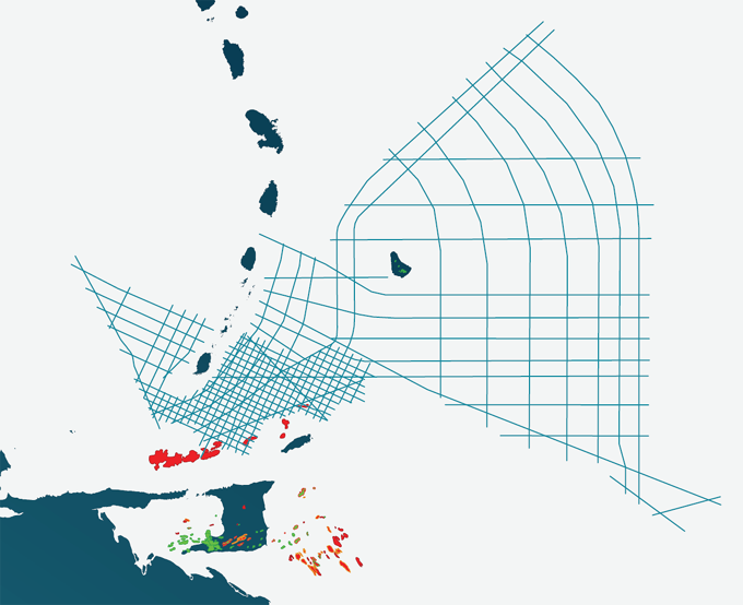
The Caribbean Atlantic Margin Deep Imaging survey is designed in two grids. The Regional Grid is designed to assist oil companies to better understand the regional tectonic framework of the various basins along the Southeastern Caribbean and Western Atlantic margin of Northeast South America. The Detailed Grid, off Trinidad and Grenada, is to provide more detail, tying the producing areas to the underexplored deeper part of the Tobago Trough. The Tobago Trough is an under explored area flanked by oil and gas production to the East and South in Barbados and Trinidad and Tobago and recently, with a new gas discovery offshore Grenada.
Based on seismic interpretation of the 2013 MCG 2D survey in Barbados, a thick sedimentary succession can be observed in the Tobago Trough. The presence of a mature La Luna oil prone source rock in the Trough seem likely.
The Caribbean Atlantic Margin Deep Imaging survey ties the Sandy Lane well in Barbados, the Orchid and Hibiscus and several deeper wells in Trinidad and Tobago, and the Nutmeg-2 well in Grenada.
The data has been processed in both time and depth by DUG, utilizing the latest broadband technology. High quality pre stack time, pre stack depth, gravity and magnetic data is available for licensing.
The Caribbean Atlantic Margin Deep Imaging survey was acquired in 2019 and covers offshore Barbados, Trinidad and Tobago, Grenada and St. Vincent.
The survey is available for the upcoming licensing rounds in Trinidad & Tobago and Barbados.
KeyFacts Energy Industry Directory: Geoex MCG