Steve Thorpe, Geospatial data specialist and lead driller, BGS, discusses returning to fieldwork after the COVID-19 pandemic and trying out the Tromino kit.
As with many people suddenly finding themselves working at home, my natural flow of work has been disrupted. When I got the opportunity to get out into the fresh air recently to undertake some fieldwork, I wanted to share the benefits this had on me and my team at BGS, and to talk a bit about the work we’ve been up to.
Missing fieldwork
Lockdown has been a tough journey for most of us. I’m sure I’m not alone in saying that working from home has had some advantages and some disadvantages. It’s certainly cut down on things like petrol use and spending money, but a major disadvantage is missing out on bumping into colleagues in the office and having those organic, face-to-face conversations, exploring ideas and discussing the research we’re working on. And, for geologists especially, being unable to go out on fieldwork and learn more about the world around us has been very affecting.
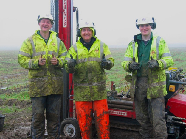
Steve and colleagues doing fieldwork in typical fieldwork weather, before the COVID-19 pandemic. BGS © UKRI.
Trialling Tromino
My role at BGS is mostly office-based, but I love being in the outdoors generally (I’m a massive nature nerd!) so I thoroughly enjoy any fieldwork I can take part in. I am part of the Shallow Drilling Facility at BGS Keyworth, along with Helen Smith and Dave Morgan, who are both pushing forward a passive seismic technology called Tromino. Their fieldwork proposal came at the perfect time to lift my spirits, allowing me to feel part of a team again, as well as providing me with some more experience with the Tromino technology.
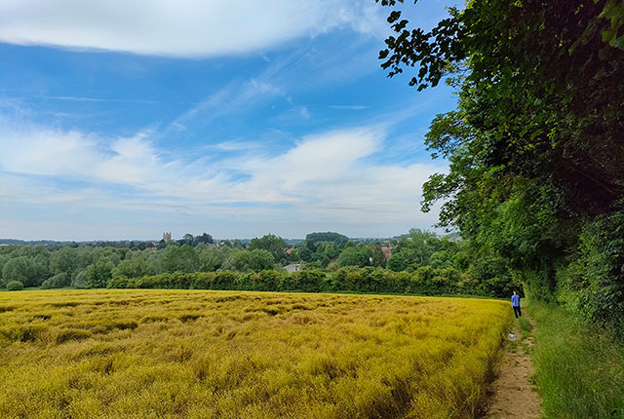
Surveying along the edge of a wooded field. BGS © UKRI.
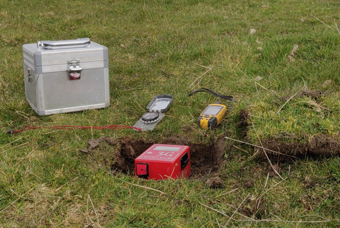
Tromino toolkit in the field. BGS © UKRI.
The Tromino is a small box that measures the natural rumblings of the Earth and can be deployed really easily. It takes 8–12 minute readings in one spot; then you can move on to a new spot for more readings and continue thus to complete a transect of several points. Once the data is downloaded and run through the software it can provide a cross-section type view of the geology, with a particular emphasis on picking out changes in velocity between geological units. It’s a really neat piece of equipment and a great addition to BGS’s geophysics team.
Helen and I undertook the fieldwork and she was a perfect field partner! She did all the hard work by getting the various COVID-19 forms filled out and approved, arranging the actual work and liaising with various landowners to get access. The fieldwork lasted two weeks and, in that time, we got some very mixed weather, but even two days of constant rain in the second week still didn’t dampen our spirits! We completed seven transects involving more than 400 points (roughly 50 points per day). We saw some wonderful scenery and could take pleasure in the nature around us, which for me helps to keep me grounded and gives me the freedom to think.
The opportunity to go on fieldwork with BGS colleagues and reignite the sense of community and teamwork is one I feel very grateful for.
Collaborating and integrating other data
We also caught up on a water borehole being drilled by another company. This was fantastic as it gave Helen and I the opportunity to see a bigger rig in action. We will be able to use the geological data from the other rig to calibrate our Tromino results because it gives us a better understanding of the ground. This was a great bit of collaborative work! At the end of all this we’ve hopefully created some useful data for the project to take into the 3D environment, which can be used to constrain the geological ground model.
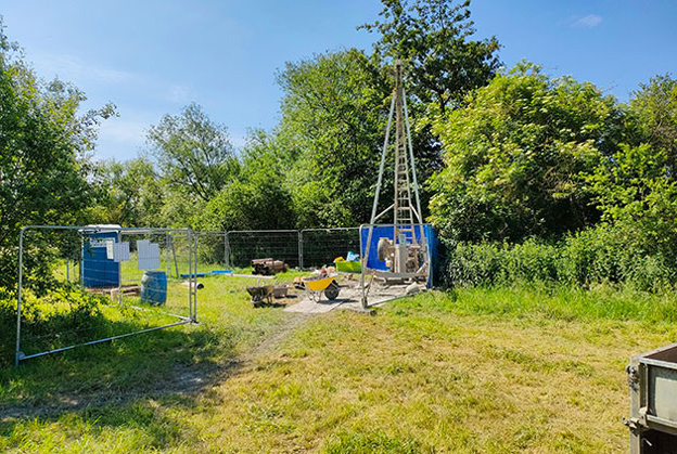
A borehole being drilled using the cable percussion technique. BGS © UKRI.
We are really keen to encourage people to use the Tromino kit, as it can provide some good data to feed into 3D modelling, for example, but the data should be tied into borehole data in order to calibrate the results. The Tromino data needs to be processed before it can be visualised properly; to do this you need to understand a bit about the ground before you start. Borehole data can provide those measurements, which can be input to create the velocity measurements and conversions inside the software. For this reason, Tromino and our drilling rig are a perfect partnership!
If you want to find out more about the Tromino or the Shallow Drilling Facility then please get in touch.
enquiries@bgs.ac.uk
Stephen Thorpe
Geospatial data specialist and lead driller, BGS Keyworth