Consider for a moment the impact of a global GPS outage. Then, try to grasp the magnitude of the financial loss that would result if that occurs. And that’s before we even consider the implications for vital life systems.
Let us now look at a less catastrophic but more realistic situation. The loss of signal accuracy can wreak havoc on data acquisition, posing a threat to global systems comparable to a GPS failure. This is where GPS Sync comes into play. And you may rest assured that Verif-i engineers are on top of things. The company’s GPS Sync solution uses cutting-edge innovation to ensure precise GPS and UTC timestamps.
Why has GPS timing accuracy become so critical?
The demand for position, timing and distance data has grown. Ironically, the rapid technological advancements in wireless data networks over longer distances and the competency of remote sensor development have increased the demand for denser seismic data procurement and many more nodes. In addition, large-scale seismic data acquisition demands extremely accurate timestamping, without which systems fail.
GPS transmissions must also contend with atmospheric interference, satellite geometries, obstruction from Earth, and solar storms, in addition to increased demand. Disturbances of this nature can introduce inaccuracies into the GPS system, causing synchronisation to fail.
Although GPS Sync is suitable for a wide variety of applications, including marine, land surveying, and mapping, let’s focus on its use in seismic data acquisition and examine some of the features offered by this versatile instrument.
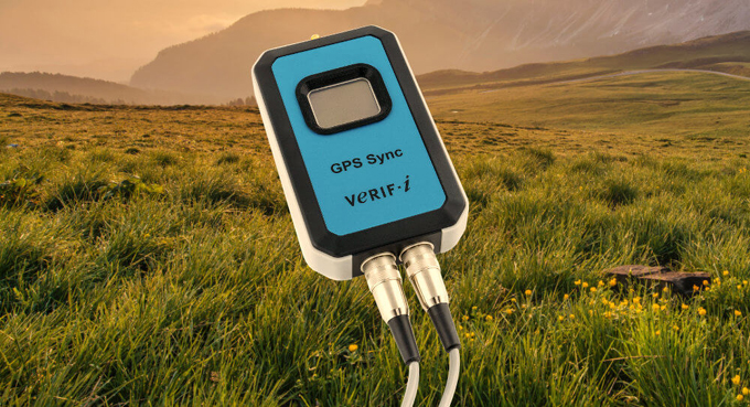
What does the Verif-i GPS Sync do?
The Verif-i GPS Sync uses the Global Navigation Satellite Systems (GNSS) to timestamp events, such as timebreaks from seismic sources. The timestamps can be referenced against GPS or UTC times. When the collection of seismic data shows errors in time syncing, the recorded information loses meaning.
In the pursuit of accuracy
Because of its speed and accuracy, the GPS Sync tool stands out from the crowd. Now let’s look at some specifications that demonstrate the unit’s capabilities:
- View event trigger times captured with an impressive nanosecond resolution.
- With a typical accuracy of <1 μs and repeatability of <100 ns, the unit’s performance is difficult to beat.
- Timestamps can be recorded with a GPS atomic reference or a Coordinated Universal Time (UTC) time reference (18 seconds but it can change).
- To reduce errors, speed up connections with multiple frequencies, and increase availability and redundancy, the unit supports dual-band GPS/GLONASS systems.
Plenty room to record and store
The GPS Sync tool’s excellent features include cutting-edge capabilities for recording, displaying, and integrating data.
- To avoid false or multiple triggering due to switch bouncing, the GPS Sync includes a 250 ms blanking period following each trigger, resulting in cleaner, more accurate recordings.
- Due to the large volume of events, data must be parsed easily and quickly by external software. Saving data on the GPS Sync is easily accomplished by creating fixed-width text files with a small footprint.
- The instrument also collects the uncorrected latitude and longitude coordinates together with the timing data for each event, enabling you to perform post-processing corrections.
- The instrument records the GPS or UTC time reference and the number of satellites with the timing data it receives.
- Each day, all records are saved in separate files.
- With the included 2 GB SD memory card, you’ll never run out of storage space on the GPS Sync. It can store over 20 million records in up to 300 data files.
The ideal balance – software and usability
The Verif-i GPS Sync scores a perfect score of 100 out of 100 for usability. The easy-to-use Windows app does not require installation. Instead, connect the instrument to the controlling PC, and the Windows Plug ‘n Play driver will take care of the rest. All software functions, such as downloading, setting or modifying parameters and deleting data files, are performed via the USB port. You can also examine your data and other essential information, such as the number of satellites, on the LCD in real-time.
Inside and out the Verif-I GPS Sync
The Verif-i GPS Sync hard carry case and its rugged build make it ideal for use in challenging environmental conditions. Travelling by air raises no safety problems because the unit has no internal battery. Instead, the GPS Sync is powered by a USB cable connected to a PC, a USB power bank or a 12-volt PSU. Current consumption is 100 mA. Electrical isolation is provided between the unit’s circuitry and the devices under test using an opto-isolator. Alternatively, triggering can be achieved with the optional TTL trigger cables.
Rest assured that it is impossible to interrupt or change your data reception and transmission flow accidentally. You can’t go wrong with the Verif-I GPS Sync because it has no external switches or controls.
Cutting-edge seismic auditing technology at its best
Verif-i has successfully demonstrated its expertise as a global leader in seismic system testing. Additionally, the organisation is no stranger to GPS timestamp synchronisation, critical for acquiring seismic data. The predecessor to the GPS Sync has been successfully deployed in the field for ten years. The new GPS Sync model includes enhancements and addresses the challenges of data collecting in an increasingly congested environment.
KeyFacts Energy Industry Directory: Verif-i