Fugro has entered into a strategic collaboration with Esri, the global leader in geographic information system (GIS) software, to provide integrated geospatial solutions that empower climate resilience decision-making and sustainable development.
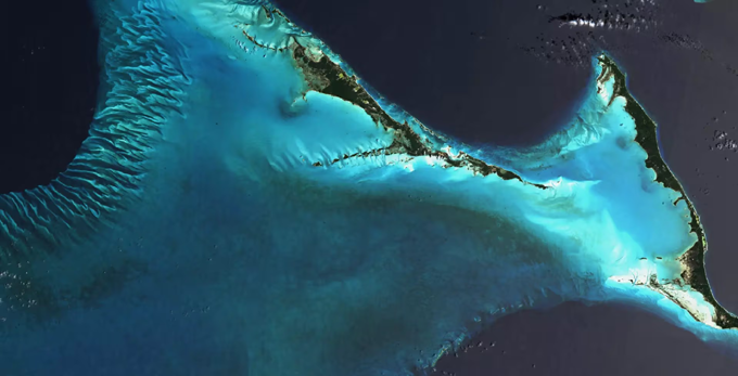
Initially, the joint effort will focus on tackling the environmental challenges of Small Island Developing States (SIDS), starting with SIDS in the Caribbean. Nearly 22 million people in SIDS live less than six metres above sea level, placing communities and infrastructures at high risk from coastal hazards. Yet, data gaps remain a major barrier. Many countries don’t have access to timely, user-friendly, and coordinated environmental data systems, especially at the land-sea interface. Fugro and Esri are helping SIDS confront urgent coastal and marine threats while building the foundation for long-term resilience and sustainable development.
The initiative is met with enthusiasm by the Organisation of Eastern Caribbean States (OECS) and the PVBLIC Foundation, who are both actively advocating sustainable development support for SIDS in the region.
His Excellency Dr Didicus Jules of OECS said,
“This collaboration between Esri and Fugro exemplifies the kind of strategic partnership the region needs- where geospatial innovation meets actionable environmental intelligence. While high quality data is essential, it’s the insights derived from that data that empower our member states to make informed, timely and transformative decisions. In the face of climate change, we build resilience not through rhetoric, but through real solutions that drive purposeful action.”
Greg Scott, Executive Director of the SDG Data Alliance, an initiative of the PVBLIC Foundation, said,
"We believe in the power of public-private partnerships to advance resiliency among SIDS and are excited about the potential impact of this strategic collaboration, knowing well that Fugro and Esri exemplify the power of data-driven innovation for resilient prosperity. Collectively, as global data and technology providers, they bring to the fore much needed coastal and marine environmental expertise and solutions that will address and mitigate the urgent climate challenges faced by SIDS."
“Esri is proud to partner with Fugro, as well as the PVBLIC Foundation and the SDG Data Alliance in helping SIDS to build stronger data governance and management to support better data collection, as well as the protection, transparency, and sharing of these assets,” said Dr. Dawn Wright, Chief Scientist of Esri. “This is how we truly harness the impacts of science and technology and measure progress toward the ABAS goals, ensuring that no one is left behind.”
The collaboration will combine Esri’s market-leading geographic information system (GIS) software- the mapping and location intelligence platform, with Fugro’s capabilities in satellite Earth observation, high-resolution surveys, in situ measurements, and predictive modelling, to deliver end-to-end geospatial solutions. Central to this integration is Fugro’s VirGeo® platform, which will serve as the core system for managing and analysing Geo-data. Together, these technologies will provide decision-makers with timely, actionable insights to support smarter, faster, and more resilient planning to face their challenges.
Mark Heine, CEO Fugro said,
“Partnering with Esri reinforces our shared vision: transforming geospatial intelligence into meaningful impact. By uniting Fugro’s Geo-data expertise with Esri’s renowned GIS technology, we’re equipping island nations with the tools to navigate climate risks and shape a more resilient, sustainable future.”
The integrated solutions from Fugro and Esri are designed to be scalable and also adaptable to other sectors and regions. These could include offshore wind, maritime security, sustainable infrastructure, and nature conservation.