On 21 August 2019 Bahamas Petroleum, the oil and gas exploration company with significant prospective resources in licences in The Commonwealth of The Bahamas, announced a coordinated approach toward drilling an initial exploration well(s) in 2020.
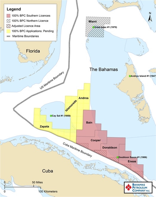
Map source: Bahamas Petroleum
Further to this, and also in support of ongoing farm-in / funding discussions, the Company has continued to undertake a range of related technical work to continue to systematically reduce and mitigate play and prospect risk whilst also seeking to optimise the location of the upcoming exploration well(s) targeting the large structures that form the Company's sizeable prospect inventory. We are pleased to update shareholders on the results of this work.
Summary
As the Company moves forward to drilling operations, the Company has directed additional technical work in support of a successful initial exploration well(s), by: (a) seeking to increase confidence in the presence of hydrocarbons within the large structures to be drilled and therefore further reducing the play and prospect risks on the significant volumes of resource contained therein, and (b) optimising the location of the proposed exploration well(s), so as to maximise the chance of both operational and commercial success.
Consistent with these objectives, over the last several months the Company has undertaken four separate subsurface studies, in each case making use of expert third-party consultants. A description of and the conclusions derived from each study are summarised below. Each of these studies has now been included in the Company's extensive technical dataroom.
Taken collectively, these studies highlight the likely presence and quality of a world-class source rock and petroleum system located precisely in the BPC licence area, with charge and migration pathways evident to deliver hydrocarbons into the identified structures. The Company believes that hydrocarbon indicators have now been established from the 3D data with the reservoir rock demonstrating a well-developed fault and fracture system that will significantly influence the final selection of exploration well(s) drill sites so as to provide the highest confidence of encountering hydrocarbons.
1. Seismic Attribute Mapping - Self Organising Maps (SOM)
To maximise the flow of fluids from the surrounding reservoir into the well bore, it will be important to site the Company's exploration well(s) in a location where the well bore intersects the optimal site for the development of fault and fracture systems.
The Company has thus undertaken a seismic attribute study of its 3D data, making use of leading-edge industry technology. The objective of this study is to better determine the fracture and fault network local to proposed well locations.
To date the Company has predicted that the structural thrusting and folding genesis of the carbonate reservoir lithologies within the drill prospects would naturally lead to significant fracturing and thus enhanced reservoir quality. The attribute mapping study has now clearly demonstrated the presence and delineation of an extensive fracture and fault system within the 3D seismic area, thus validating what had previously been predicted. The Company considers this to be an extremely positive result. Increasing the Company's understanding of reservoir porosity and permeability will assist in the final, optimal positioning of the exploration well(s) inside any potential 'sweet spots' within the fracture / faulting network. This will maximize the chance of detecting hydrocarbons in the exploration well, in a way that the Company expects would maximize flow rates in a success case with knock-on impacts to potential future production economics.
2. Geophysical / seismic interpretation
A common industry pre-drill evaluation step for exploration in frontier basins is obtaining supporting geophysical evidence in the form of amplitude, attribute or anomaly analysis of seismic data. However, in the types of carbonate rock systems which characterise BPC's prospects, detailed analysis is more complex than for other rock systems. Notwithstanding this complexity, the Company has successfully undertaken a detailed evaluation of seismic amplitude, attribute and velocity from the Company's 3D data.
Importantly, these studies have demonstrated:
- what the Company and its consultants believe to be direct hydrocarbon indicators (DHI's), consistent with an indicative presence of hydrocarbons within mapped structures;
- strong amplitude conformance to structure, with amplitude termination / switch-off against faults and variation with depth, characteristics that are usually indicative of the presence of reservoir porosity and permeability; and,
- seismic interval velocity reduction and variations between the target structure and the surrounding areas, characteristics that are usually suggestive of fracture porosity within the folded structure and detection of reservoir intervals within structural closure.
In short, the Company considers the results of these studies to be significant, in that they may directly indicate the presence of hydrocarbons in the structure(s) at the intended drilling location(s). This adds to the already sizeable body of evidence, derived both internally and from independent advisors and experts, in support of the Company's view that technical risk of the prospects is relatively low, thereby increasing confidence in a successful outcome of the exploration well(s).
3. Paleogeographic reconstruction
A Jurassic hydrocarbon source rock is ubiquitous across the region, and is known to generate hydrocarbons in the major production fields of the Gulf of Mexico and northern South America. In order to further increase technical confidence for potential petroleum systems and source rock distribution directly at the location of the Company licences a detailed paleogeographic and conjugate margin reconstruction study of the Caribbean, Northern South America and West Africa has been undertaken.
This study has corroborated the likely presence of a Late Jurassic oil-prone source rock and active petroleum system in the Santaren Channel, which is the precise location of BPC's licences and the intended drill site. This Late Jurassic source rock is analogous to the Smackover interval producing in deep-water Eastern US Gulf of Mexico, and has also been calibrated as the source of nearby onshore Cuba oil production. This Late Jurassic source rock is in addition to the previously recognised Early Cretaceous source rock in the region, also sourcing production in nearby Cuba and onshore Florida.
4. Cuban oil sample analysis
Through a reciprocal technical cooperation agreement with the Cuban National Oil Company ("CUPET"), the Company accessed 3D seismic data adjoining the BPC's licence areas in Cuban waters. In addition, CUPET provided to BPC oil samples that were subsequently independently analysed to assess the age and chemistry of the source rock linked to onshore production in Cuba.
The Cuban 3D seismic and oil sample data has corroborated the likely source rock charging the Company's drill prospects as late Jurassic. This is the same age and type of petroleum system, Bossier-Smackover, that charges the deepwater fields in the Eastern US Gulf of Mexico and nearby Cuba.
Simon Potter, Chief Executive Officer of Bahamas Petroleum Company, said:
"As we move forward operationally, and in view of ongoing farm-in and funding discussions, we have continued to undertake related technical studies. The objective of this work has been to further reduce subsurface risk by demonstrating the existence and quality of the petroleum system components, and also to optimise the location of the wells we intend to drill. We are most encouraged that these four most recent studies have each produced positive results, which when taken together support the potential presence of hydrocarbons in identified fractured networks, thereby serving to further technically de-risk the drill candidates and reconfirming our view that our prospects in The Bahamas represent a drill ready, potentially multi-billion barrel prospect inventory."