In association with the ANPG, Trois Geoconsulting and DDMS offer a recent integrated Geological Report and ArcGIS Project of the Onshore Kwanza Basin. The fully interpreted geological dataset covers the entire basin and is designed to support oil and gas exploration projects within the blocks available in the upcoming Angola Onshore Bid Round 2020. Data available includes enhanced geological mapping, remote sensing data, digital petrographic samples, outcrop studies, seismic & well data.
Geological Map and GIS Database of Kwanza Basin onshore
- Layered GeoPDF Map of Kwanza Basin containing all selectable layers. PDF Regional Report in Portuguese (200+ Pages). ArcGIS Project with Geology and location of main cultural features (Sample location, Outcrops, Wells and Seismic Locations).
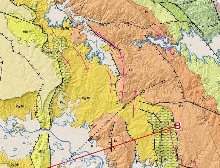
- Enhanced and Fully Integrated Remote Sensing Geological Map at 1:50,000 scale (2020)
- Data integrated with outcrop control from Obrangol 1:250,000 scale map; Landsat, ASTER, PalSAR and SRTM image data interpreted at 1:25,000 scale, presented at 1:50,000 scale.
- Available for individual blocks or for the entire basin.
KeyFacts Energy Industry Directory: Trois Geoconsulting